Preparations
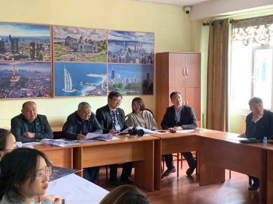
After the opening ceremony of the workshop on April 23, Kyrgyzstan’s Osh Technological University (OshTU) assigned a local student for each of the survey teams, showed the teachers and students around the campus, and briefed the teams on their survey around the Sulayman Mountain (Sulaiman-Too).
Located above the Fergana Valley, the Sulayman Mountain lies on an important crossroads of the Central Asian part of the ancient Silk Road. For Muslims in Central Asia, it is venerated as a sacred mountain and the second holiest place after Mecca.
Scope of Design
On-site Survey
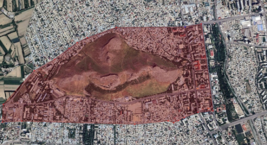
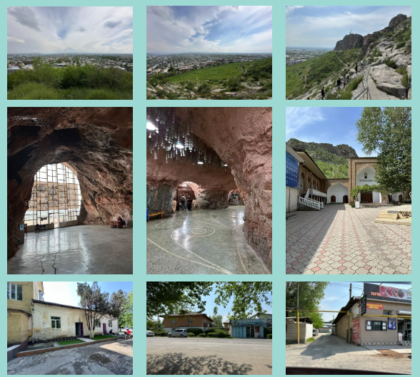
The Sulayman Mountain has been a beacon for travelers for one and a half centuries. It is a UNESCO World Heritage Site with numerous cult places in ancient times on its five peaks and slopes, caves with petroglyphs, as well as two mosques rebuilt in the 16th century. The National Historical and Archaeological Museum Complex Sulayman with 13 exhibition rooms is like a pearl placed in a space of both natural and man-made cave on the side of a peak. It was built to protect the petroglyphs found in the cave, and its architecture is as valuable as the exhibits inside. There is a neat disposition of residential blocks on the south of the sacred mountain, and the Grand Bazaar to the northeast is a famous trading market in the region. In their early design, many students chose to integrate the resources around the mountain to develop tourist routes in an effort to revive the economy in the area. But they found in their on-site survey that the business atmosphere around the mountain was not strong enough. The area on the south of the mountain displays a similar landscape to urban villages within big Chinese cities, giving the students a feeling of occlusion and high population density. But in their actual visits, the students felt a moderate density and agreeable greenery, which was different from what the map shows and their presupposition. This reality changed the students’ strategy in their designing.
Surveying and Mapping of Ancient Ruins in Uzgen
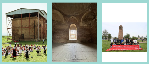
Uzgen is located in the fertile Fergana Valley, which is mentioned as “Dayuan” in Chinese historical works since the second century BC. The region once produced Ferghana horses, known as the “Heavenly Horses” that Emperor Wu (156-87 BC) of the Han Dynasty dreamed of. The existing remains include the Uzgen Minaret (an 11th-century tower), three mausoleums of the Karakhanids (a khanate that ruled parts of Central Asia from 840 to 1212), a mosque and its residential ruins. Among them, the Uzgen Minaret was once 44 meters tall, standing next to the mosque to summon prayers. As Uzgen is an earthquake-prone area, half of the minaret collapsed, and it was repaired in 1923. Today, the tower is only 27 meters tall, but it still looks lofty because it is located on the highest construction platform in the city, and the building is much higher than the surrounding three- or four-story modern houses. It is not only a witness to the history of Uzgen, but also a symbol of the town. There is also a group of large-scale and majestic buildings in the area: three mausoleums with a total length of 30 meters, a width of 13 meters and a height of 10 meters. It was not an easy task in the surveying and mapping. Since the top of the mausoleums are covered by a protective ceiling, the outer surface of the domes could not be measured. The team members had to use the method of photogrammetry to constantly adjust the angle and look for proportional changes in height on the side elevation. Most of the roofs of the mausoleums is behind a large screen door and is composed of a dome and a flat roof. Its thickness and connection relationship are not available. There are masonry stairs spiraling up within the minaret, and the width and height of the steps are different. In addition to the verification of scales, search of data was also required to get more accurate ideas of the construction. As this survey was conducted during the ninth week of the semester, the students had made drawings and models in China of the areas around the Sulayman Mountain, analyzed the planning of the areas, and planned the urban design of each group. Fieldwork can enable students to get a better understanding that urban development cannot rely solely on drawings. This visit has given them a deeper knowledge of the local life, religion, society and people.
Midterm Presentations
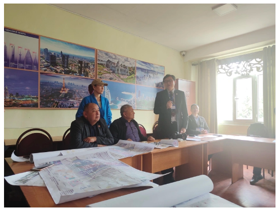
The midterm presentations were launched successfully at the lecture hall of OshTU, with the participation of six teams of students from Xi’an University of Architecture and Technology (XAUAT) and OshTU. Other participants included Professor Li Yueyan, Professor Song Hui, Chen Yalan and An Li from XAUAT, as well as Dean Dzhusuev Umetali and Vice Dean Abdullaev Ulan of OshTU Faculty of Architecture and Construction. Professor Li Yueyan said in his opening remarks, “We will maintain contacts and strengthen exchanges with teachers and students of OshTU, and hope to deepen cooperation and interactions in multiple fields. At the same time, XAUAT will continue to create a friendly and open environment for international exchanges, carry out more international exchange programs, and improve the level of interactions in student cultivation and the quality of education.” Dean Dzhusuev Umetali said, “It’s a great pleasure to meet teachers and students from China. This opportunity of exchange initiated by the Belt and Road Joint Laboratory gives us a better understanding of China. The exchange of courses also represents an exchange and dissemination between cultures. We look forward to more opportunities for cooperation in the future.”
Team A: Mao Yufan, Wu Jirui, Mu Dixin, Nadira Kadyrova
Their design aims to promote urban development through spaces for public life, historical and cultural sites, economic planning, as well as the enhancement of connections within communities. It consists of three stages emphasizing the integration of all fronts and covering the protection of historical relics, improvement of roads, market activities, community planning, etc. It proposes solutions to the current lack of spaces for public life, the utilization of underground space and population transfer. It aims to promote communication, connect communities, inherit history and meet current needs.

Team B: Xiang Siyun, Zhao Wenxuan, Chen Jiaxin, Begimai Ulukova
The team proposed the concept of “slow tourism” to drive economic and cultural development through the development of tourism. Osh is an ideal travel destination with its unique geographical location, pleasant climate and cultural diversity. Based on this, the team recommended road improvements and construction of greening system, and plans cultural routes, commercial travel routes, and a pedestrian system in the riverside park. They took into consideration future programs such as promoting the riverside park, transforming the architectural features and building an urban park. It aims to enhance spaces for urban slow tourism and promote economic and cultural development.

Team C: Yan Borui, Chi Kaiyi, Wen Chenqing, Dastan Abdukaimov
The plan is inspired by the structure of neural networks. The team members held that the parts of a city are interconnected like the nerve cells. They screened the important information about Osh, identified their connections, and integrated the parts of the entire city into a whole with the Sulayman Mountain at the core. They designed the central axis and key “neurons” of the Sulayman Mountain, radiating from the center outwards. The plan adjusts the road planning and green space planning, and reconstructs the commercial travel routes and spaces for public life, highlighting the central status of the sacred mountain. The members said, “We do not intend to demolish the original Soviet buildings during the renovation. We hope to preserve the historical episodes and combine them with modern new functions, in an effort to preserve the memory of the city to the greatest extent.”

Team D: Zhang Xun, Yu Kexin, Li Jingxuan, Abdumitalipova Aiperi Zhanyshbekovna
The theme of their design is “pilgrimage”. Osh is an important learning center in Central Asia and an important node on the Silk Road. The group members hoped to turn Osh into the fourth largest Islamic pilgrimage site through urban planning. They presented their plan from three major aspects: the sacred source, the pilgrimage route and the sacred bridge.

Team E: Huang Jingwei, Guo Yanfang, Gao Yunji, Asem Turdubek Kyzy
The team studied three types of potential customers: Muslims, local residents and foreign tourists. They believed that Osh has considerable potential in terms of its transportation, is surrounded by many historical and natural spots, and is one of the best starting points for visiting the Pamir Mountains. They hoped to bring new development to Osh through tourism planning.

Team F: Tian Liting, Chen Shuanglian, Aidarbek Turapov
They presented the research on the protection of and mapping of the ancient buildings of the Uzgen Minaret and the mausoleums of the Karakhanids. They compared the similarities and differences between mosques in China and Kyrgyzstan, and shared relevant research on the Daxuexixiang Mosque in China’s city of Xi’an, explaining the localization process of religious buildings.

Video clip of mapping
Video clip of presentations
In the closing remarks, Dean Dzhusuev Umetali expressed high expectations for the students and hoped that they will continue their efforts, cherish the opportunity of exchange, and promote the Belt and Road Initiative as well as the prosperity and development of the region.
Teachers from XAUAT exchanged gifts with teachers from OshTU, and invited Dzhusuev Umetali, Tazhidinov Islam, Mamytov Akparali, Abdullaev Ulan, Toktobekov Samarbek and others to visit XAUAT.
They expressed their willingness to strengthen exchanges and connectivity, establish and improve long-term communication and exchange mechanisms, join hands to promote more in-depth, wide-ranging and higher-level cooperation.
They vowed to jointly create a model for green buildings and urban design along the Belt and Road, and build this program into a platform for educational, technological and industrial cooperation along the Silk Road featuring consultation, contribution and shared benefits, so as to carry forward the spirit of international cooperation that has been upheld along the Silk Road for thousands of years.
